Geo 第5页
Geology & Exploration,Drilling And Workover softwares.

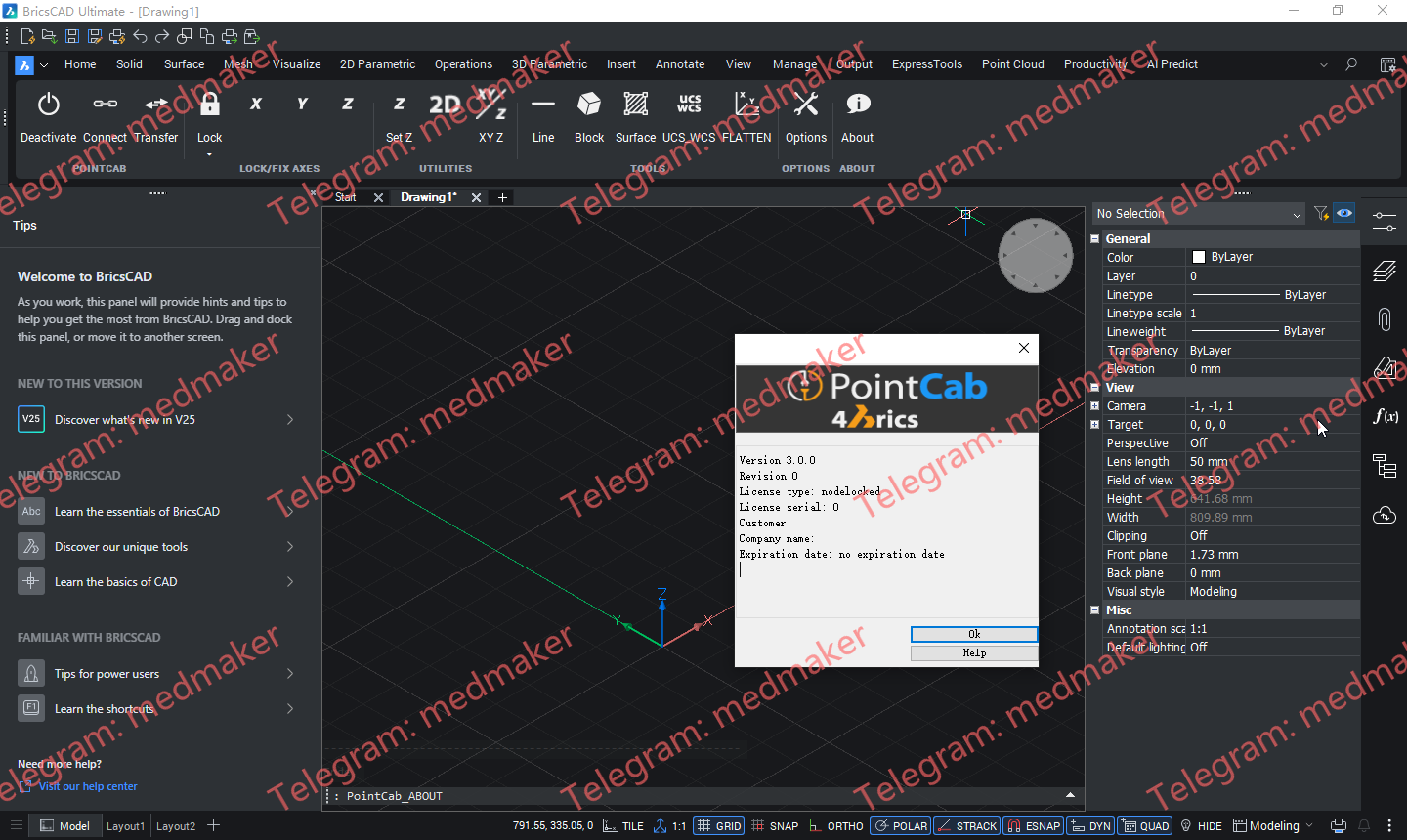
POINTCAB 4BRICS 插件(PointCab BricsCAD 插件)我们的 BricsCAD 插件为 BricsCAD 中的点云建模提供了最便捷的工作流程之一。 可用版本: 3.x , 2.x ,… PointCab 4BricsCAD 3.0 Tested Picture 插件功能简介: 无需导出/导入点云数据 直接传输线、圆等 直接传输 3D 信息 正确定位自定义模板 与其他 CAD 软件兼容的数据转换 无需在点云中导航 兼容 BricsCAD Pro Platinum 22-26 版本 More Information in English:PointCab 4BricsCAD 3.0 Testing Video
Maptek Workbench is the central place to access and manage all of your Maptek desktop applications. It offers the following key benefits: Single integrated workspace Access all of your Maptek applications within a single, consistent interface. Open multiple applications and tools simultaneously and share data easily between applications. Customise Workbench to suit your needs. Maptek Account integration Straightforward licensing and management of licensed applications, including downloading and upgrading to latest application versions. Maptek Extend Get more out of your Maptek applications by taking advantage of Maptek Extend features including Maptek Workflows and Maptek Python SDK.
Maptek Vulcan plays a critical role from the very start of the mining process – commencing with exploration and geological modelling, ranging through mine design and scheduling to rehabilitation. Powerful block modelling and integrated tools for survey, drill and blast, grade control, geotechnical analysis, geostatistics, scheduling and optimisation make Vulcan the complete mining software package. Vulcan can manage and visualise very large and complex data sets, process the information and rapidly generate models. Sophisticated algorithms and fast processing allow virtually instant validation of data for building and maintaining up-to-date models of a deposit.
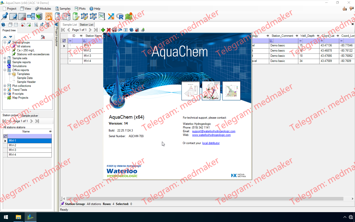
AquaChem 14.0是我们业界领先的水文地质、地球化学或环境项目软件的最新版本,该软件可用于管理、分析和报告水质数据。 可用版本: 14.x ,… Waterloo AquaChem 2025 v14.0 AquaChem 14.0 新增功能 趋势分析模块 新增了趋势分析模块,可用于对时间序列数据进行统计分析。 支持的检验和分析: 线性回归 Sen 斜率估计 Spearman 等级相关 Mann-Kendall 检验 季节性 Mann-Kendall 检验 趋势分析结果可以导出为电子表格,也可以自动绘制成时间序列图。 改进的样本集编辑器 样本集编辑器的功能已得到重大升级,使您能够以更强大、更精确的方式筛选数据。 OR 语句:样本集条件现在可以使用 OR 逻辑运算符连接。 条件分组:样本集编辑器中的条件现在可以分组。 限定符字段:样本集现在可以根据样本结果的限定符字段进行条件设置,从而可以轻松提取或排除未检测到的结果。 新增条件:新增了“不等于”、“有值”和“无值”参数条件。 绘图 绘图功能已进行多项升级。 线性回归线:现在可以在“线条”选项卡中自动计算并绘制散点图和时间序列图上的线性回归线。 符号系统切换速度更快:现在可以更改应用的符号组。直接在新“符号”选项卡的绘图设置中进行设置 带标签的线条:线条可以添加任意标签,也可以从计算出的线性回归线获取标签数据 可配置的图例位置:现在可以自定义图例的位置 箱线图改进:箱线图现在可以标注每个数据系列的样本数和未检出数 可用性 现在可以导出水质标准 现在可以从“样本报告”模块导出模型和计算的参数结果 现在可以从“样本报告”模块导出样本分析结果元数据(例如精度、结果注释等) “样本分析查看器”模块现在可以排序 新增参数现在默认可以通过参数计算器进行更新 在表格和样本集编辑器中定义日期时间数据值现在更加便捷 默认情况下,Durov/Piper 图标题不再列出所有参数 More Information in English:Thermo Fisher Scientific Lipidsearch 2026 v5.2.7
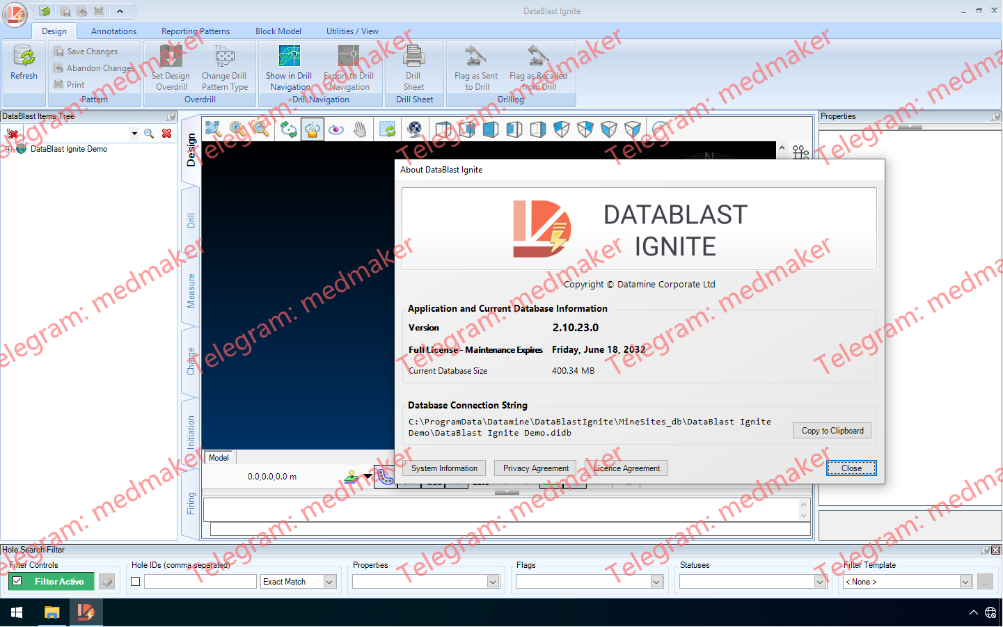
DataBlast 2.10 版本为 DataBlast Pro 引入了全新的模块化许可系统,支持 Ignite 中更高效的数据库格式,并针对钻孔和爆破工作流程进行了一系列针对性增强。这些更新旨在让您在现场配置、使用和维护 DataBlast 时拥有更大的灵活性。 可用版本: 2.10.x , 2.9.x ,… Datamine DataBlast 2025 v2.10 DataBlast 2.10的主要变化是为 DataBlast Pro 引入了新的许可模式。新的 Pro Starter 许可提供基础安装,并可选配 BlastPad 支持、钻孔导入和报告功能等附加组件——如果您只需要部分功能,这将是理想之选。原有的 Pro Core 许可仍然可用,默认包含所有功能。您现在还可以单独购买额外的工作站或 BlastPad 许可。DataBlast Ignite 仍然按机器授权,并保留其单用户模式。 此版本还将 DataBlast Ignite 的数据库格式更改为 SQLite,从而取消了之前 10 GB 的数据库大小限制。此更改旨在实现无缝衔接,备份和恢复流程会自动处理从 LocalDB 格式到 SQLite 格式的转换。 得益于高级矿场设置中的两个新选项,回填计算现在更加灵活。简化的回填模式允许您生成回填表,而无需创建完整的回填模式,从而降低了简单作业的复杂性。此外,您现在可以使用任何可用的测量深度来计算回填量,而不再局限于倾角深度。这些改进使回填工作流程更容易适应不同的现场要求。 起爆设计也得到了增强,以支持更安全、更直观的规划。新增的“起爆半径”选项会突出显示在同一延迟窗口内且位于用户定义范围内的钻孔,从而有助于标记潜在的高能相互作用。这些视觉警告使评估爆破安全性更加容易。“雷管/导爆索选择”屏幕已简化,一次仅显示两个级别,减少了滚动浏览产品列表的时间;时间导出现在遵循您的 Windows 区域设置,以提高兼容性。 DataBlast 2.10 中“每延迟层数”的起爆半径内可设置多个钻孔 钻机界面也进行了多项改进。DataBlast 现在包含一个新的 WencoMine 连接,可提供直接数据库访问,并具有自动重新处理和时间戳跟踪功能,从而在 Pro 中更可靠地导入钻孔日志。此新界面是对更名后的 WencoLite 选项的补充,并且配置设置已重新组织,以提高清晰度。由于 DataBlast Ignite 平台不支持钻井数据导入,因此其配置界面已得到简化。 其他模块改进包括:导入块模型和图形时支持新的 Datamine .dmx 文件格式,该格式允许使用扩展属性、Unicode 字符并减小文件大小。钻井处理新增了忽略无效井口或井底 GPS 位置的选项,从而更轻松地处理不一致的测井数据。此外,该版本还进行了多项界面优化,例如“关于”屏幕上更清晰的许可信息以及维护期间更清晰的井眼过滤器显示,这些都为用户体验的提升提供了周全的改进。 More Information in English: Datamine DataBlast 2025 v2.10
AVEVA E3D Design 3.1.10 是全球技术最先进的流程工厂、船舶和电力行业三维设计解决方案。它支持强大的可视化功能、无碰撞的多专业三维设计,并能快速生成精确的图纸和报告,从而降低新建和改建项目的成本、工期和商业风险。 仅使用许可证服务器文件,请勿使用已打补丁的文件。AVEVA E3D Design 3.1.10 是全球技术最先进的流程工厂、船舶和电力行业三维设计解决方案。它支持强大的可视化功能、无碰撞的多专业三维设计,并能快速生成精确的图纸和报告,从而降低新建和改建项目的成本、工期和商业风险。 仅使用许可证服务器文件,请勿使用已打补丁的文件。AVEVA E3D Design 3.1.10 是全球技术最先进的流程工厂、船舶和电力行业三维设计解决方案。它支持强大的可视化功能、无碰撞的多专业三维设计,并能快速生成精确的图纸和报告,从而降低新建和改建项目的成本、工期和商业风险。 仅使用license文件,不使用补丁文件。 AVEVA E3D Design (Everything3D) 2025 v3.1.10 Tested Picture AVEVA E3D Design 3.1.10 提供一流的生产力和功能,同时与包括 AVEVA Unified Engineering 在内的其他 AVEVA 工程和设计解决方案无缝兼容。它基于我们安全的云平台 Connect 提供,可在数天或数周内快速部署,无需数月,并可在工作的同时编译数据,在云端创建您的工程数字孪生模型。 AVEVA 发布了 AVEVA Everything3D (E3D) 3.1 版本。作为 AVEVA 集成工程与设计方法的一部分,AVEVA E3D 带来了多项重大创新,可显著提升新建工厂设计和全生命周期改造项目。其核心在于集成了激光扫描数据和 3D 几何图形;强大的绘图工具和直观的用户界面,可轻松完成常见设计任务。 AVEVA E3D 的主要功能包括: – 集成了工程和原理图专业的工厂设计系统 – 具有“真实世界”品质的 3D 建模能力,结合了最佳的 3D 图形和激光扫描点云。 – 完全自动化的二维绘图功能,并与三维模型无缝集成 – 与设计流程中使用的其他设计系统完全兼容 – 支持项目复用和模块化设计的架构,并可扩展以支持与云/移动基础设施的集成 – 可与当前行业领先产品 AVEVA PDMS 并行运行 此版本基于软件已有的卓越性能,通过提高工程总承包商 (EPC) 和业主运营商的生产力,为棕地改造项目节省时间和成本。 增强的功能,例如点云拆除和在图纸上直接显示激光数据,使设计人员能够以前所未有的方式与三维模型进行交互。 通过改进的用户界面,降低了学习难度,加快了项目投入生产的速度,从而优化了设计效率。 More Information in English:AVEVA E3D Design (Everything3D) 2025 v3.1.10 Testing Video
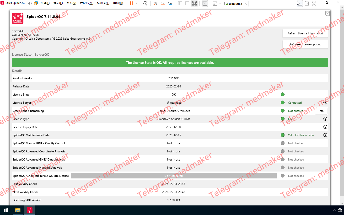
Leica SpiderQC 是一款用于 GNSS 参考站网络质量控制和性能分析的软件。 可用版本: 7.11.x , 7.9.x… Leica SpiderQC 2025 v7.11 Leica SpiderQC 是一款多用途 GNSS 数据分析工具,可用于: 站点评估和质量控制 网络 RTK 性能监测 参考站完整性监测 形变监测 RINEX 数据管理(数据拼接、抽取) More for English: Leica SpiderQC 2025 v7.11
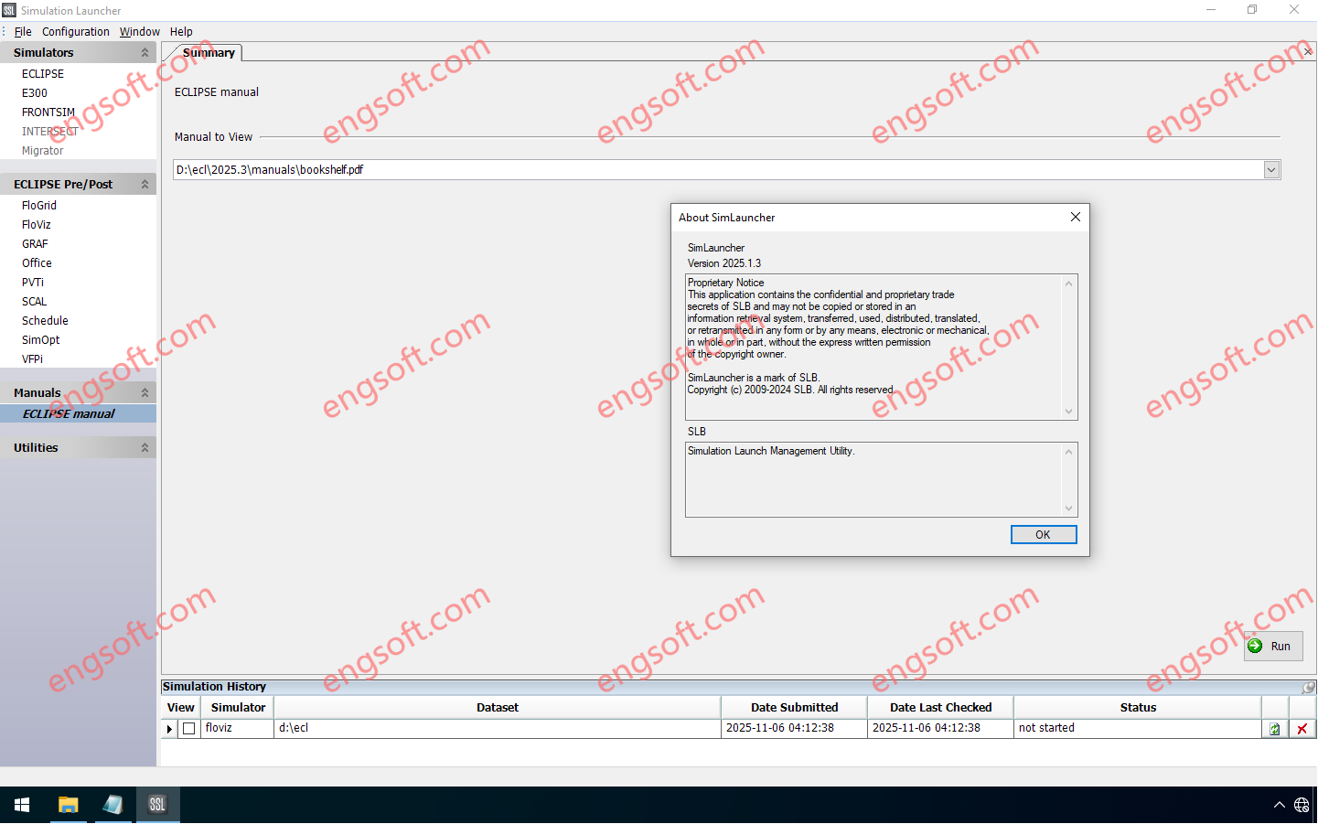
The Eclipse industry-reference reservoir simulator offers the industry’s most complete and robust set of numerical solutions for fast and accurate prediction of dynamic behavior for all types of reservoirs and development schemes. The Eclipse simulator has been the benchmark for commercial reservoir simulation for more than 25 years thanks to its extensive capabilities, robustness, speed, parallel scalability, and unmatched platform coverage. Available versions: 2025.x , 2024.x , 2023.x ,… Schlumberger Petrel and Studio 2024.9 Tested Picture The Eclipse 2025.3 release includes developments enhancing the performance, usability and functionality of the simulators. Eclipse 2025.3 Release updates Flexible well modeling with additional user defined argument (UDA) support Additional UDA support has been given to the WELPI keyword. This keyword helps directly define...
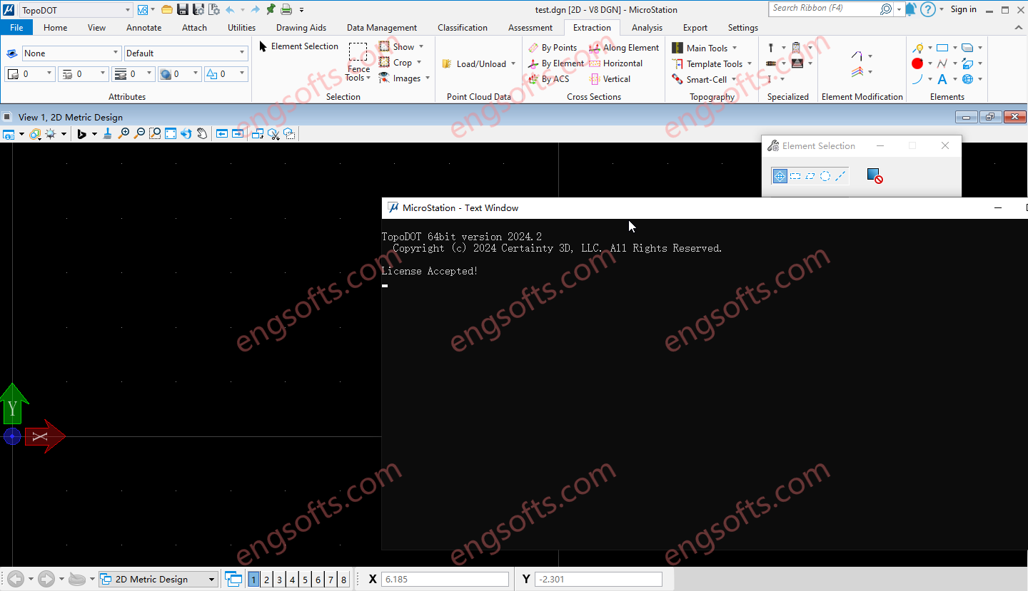
TopoDOT is a comprehensive solution to manage point cloud data, assess data quality and extract topographies, models, analyses and other forms of digital twins. Geospatial data acquired along road, rail, utility and other land survey applications present unique processing challenges. The TopoDOT production process is designed to meet these challenges with the right balance between automation and quality, thereby ensuring complex project requirements are met at the lowest possible cost. Available versions: 2025.x , 2024.x , 2023.x ,… Requirement:MicroStation CONNECT Update 15+ Certainty3D TopoDOT 2024.2 For Microstation Tested Picture Road TopoDOT realizes the inherent value of point cloud data acquired along road and highway transportation corridors. Intuitive yet highly automated tools extract complex features quickly and accurately. A quality-controlled process...
Reconcilor 9.10 delivers a major upgrade focused on usability, data integrity, and flexibility of analysis across the mining value chain. A key new feature in this version is the Embedded Analysis, which lets you host dashboards from analytics and business intelligence tools like Power BI or Tableau within Reconcilor. This helps centralise reporting and eliminates the need to switch between platforms. The Data Approval workflow has been extended to handle approvals at both global and site levels, improving traceability and control over key datasets. Updates to the Continuum screen introduce a more adaptive layout, clearer label display, and new controls for selecting visible metrics—making it easier to work with complex comparison data. The Grade Block screen has also been enhanced,...
.2025.v3.1.10.png)